
Actualité volcanique, Articles de fond sur étude de volcan, tectonique, récits et photos de voyage
Par Bernard Duyck

Pacaya - weak Strombolian activity on 24-25.06.2018 - Insivumeh photo
At Pacaya / Guatemala, the observatory reports small Strombolian explosions visible between 15 and 75 meters above the MacKenney crater; between the explosions, a degassing of white color rises to about thirty meters height before dispersing towards the west.
Internal tremor is recorded, witnessing the rise of gas and magma towards the surface.
Source: Insivumeh daily reports

Anak Krakatau - seismicity on 24.06.2018 - Doc.Magma Indonesia
The activity of Anak Krakatau seems to be maintained, without much visibility, given the fog that covers the volcano for several days.
At the seismicity level, it is dominated, according to the PVMBG, by volcanic earthquakes linked to the supply of magma (respectively 76 and 58 on 23 and 24 June) and blast events, in relation to degassing (respectively 53 and 44, June 23 and 24)
The level remains at II / Waspada.
Sources: PVMBG & Magma Indonesia

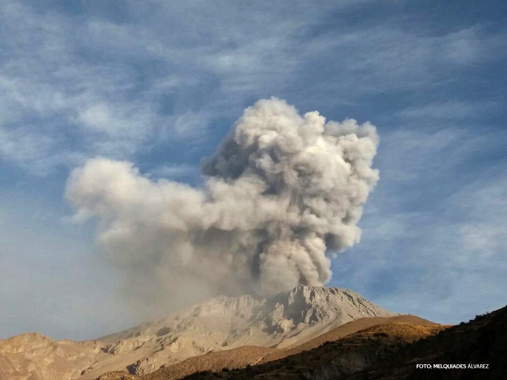
Sabancaya - activity table between 18 and 24 June 2018 - doc.IG Peru / OVI / Ingemmet
The reports of the IG Peru shows a stable and eruptive moderated activity at Sabancaya between 18 and 24 June 2018.
It is associated with an average of 29 explosions per day, and plumes of ash and gas with a height of 1,800 meters max. above the crater, dispersing 30 km to the southeast and east.
The flow of sulfur dioxide is great, with a max. of 4,900 tonnes / day, measured on June 21st. Eleven thermal anomalies were recorded, with values between 1 and 60 MW.
The alert level remains orange.

Sabancaya - photo 21.06.2018 OVI / Vlado Soto.
In Ubinas, on alert green level, the activity remains low, with gas emissions up to 130 meters above the crater, dispersed to the southwest.
The flow of sulfur dioxide is large, with 1,495 tons per day.
The seismicity is marked by volcano-tectonic earthquakes, on average 2 per day, and LP earthquakes (on average 2 to 3 per day)
Sources: IG Peru / OVI / Ingemmet

Ubinas - activity table between 18 and 24 June 2018 - doc.IG Peru / OVI / Ingemmet
Ubinas - last period of activity - archives IG Peru 03.10.2016 / 5h50

Kilauea - East rift zone - Fissure 8 and lava flows to ocean - photo Bruce Omori
In Kilauea, the situation on the East Rift Zone does not show any significant changes.
There will be changes to the cone spatter surrounding the lava fountains of fissure 8: the edges near the exit of the flow, open side, have risen with respect to the closed side.
The fissure 22 is weakly active.
The entrance of the lava into the ocean has expanded to the south

Kilauea - East rift zone - Morphological changes with spatter cone / fissure 8 - GIF USGS 14 at 24.06.2018
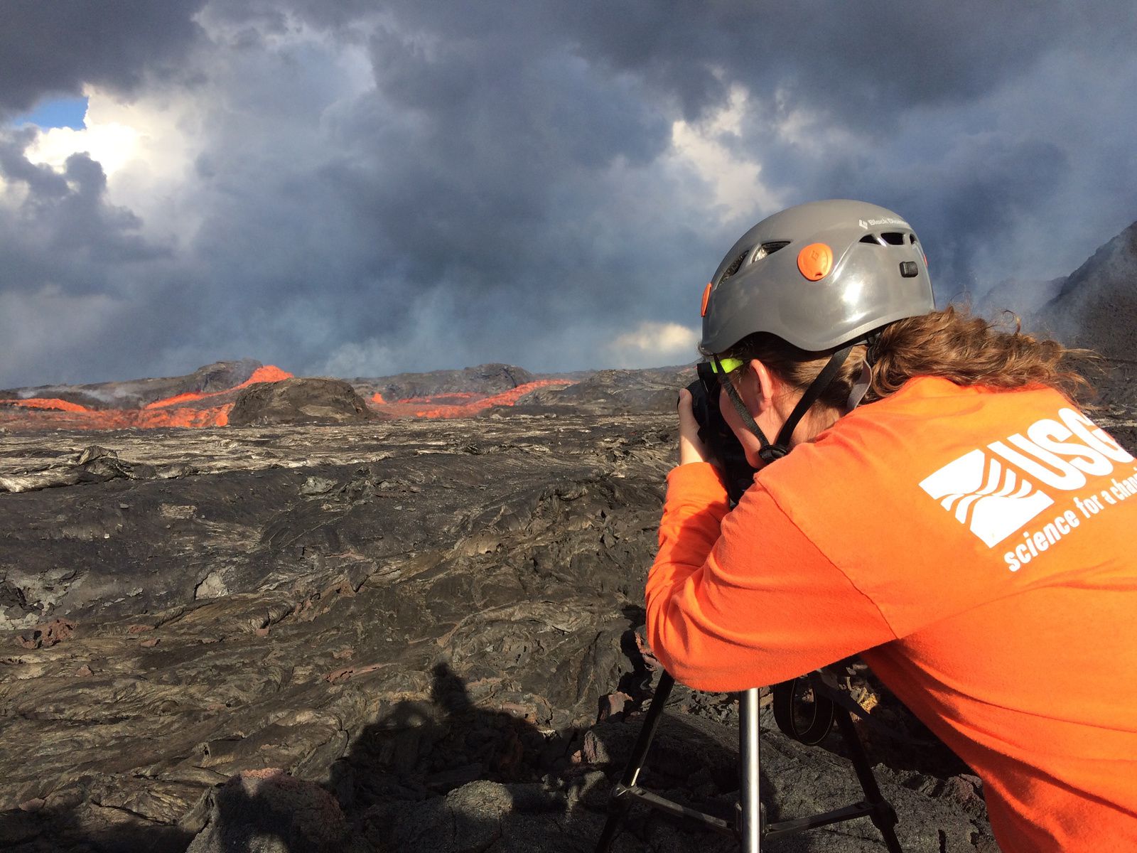
Kilauea East Rift Zone - Controls at the exit of the cone on fissure 8 by an USGS volcanologist - the speed of the flow is measured at 30 km / h.
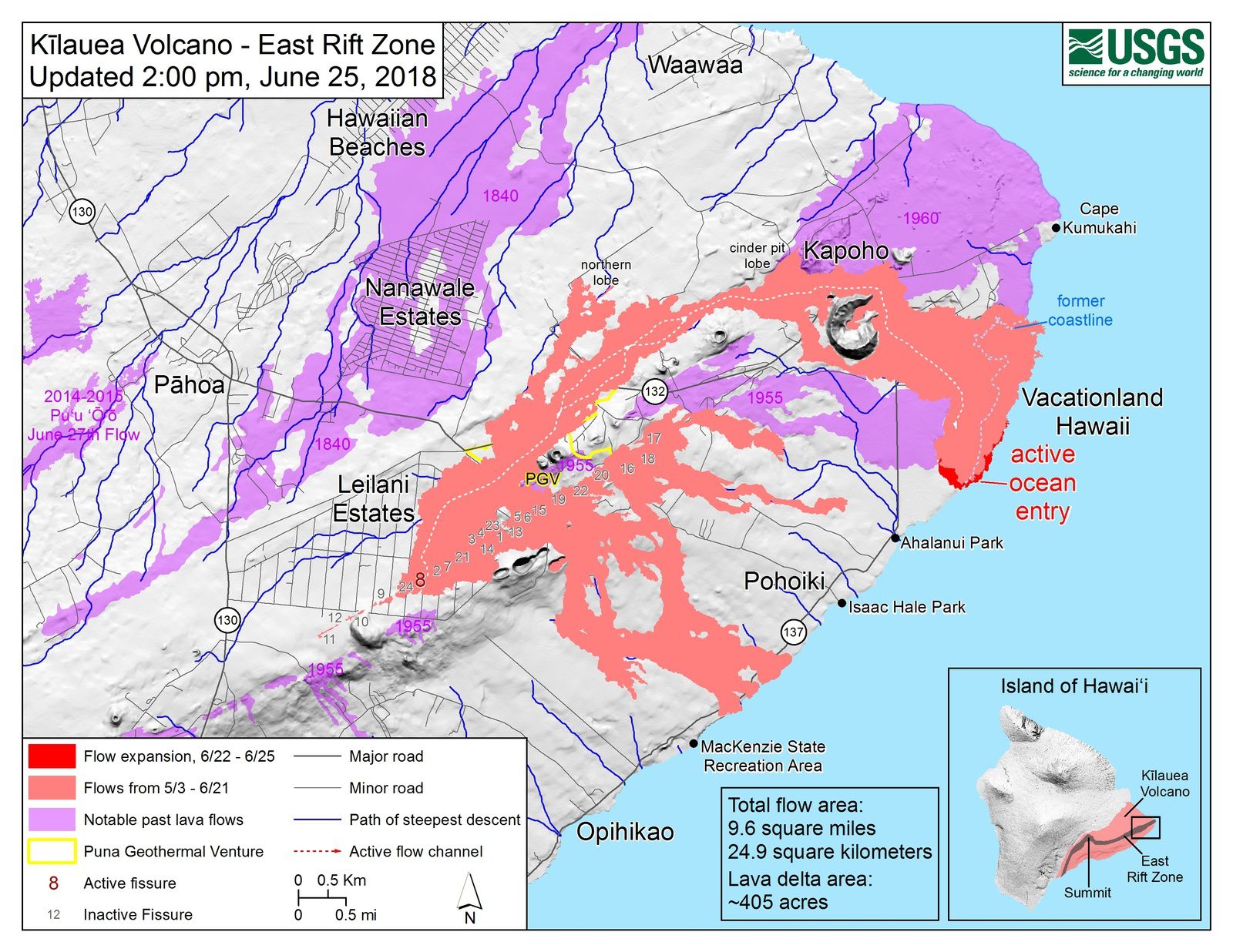
Kilauea East rift zone - map of the flows at 25.06.2018 / 2 pm - Doc HVO-USGS
At the top, a collapse explosion occurred on June 25, at 17:03 HST, accompanied by a low ash plume rising 600 meters above ground level before drifting southwest. The energy of the explosion corresponds to an earthquake of M5,3.
Subsidence continues at the top, where a measuring station (NPIT) has plunged 95 meters from its original position; it is intact, and in working order, but its alignment with the observatory is no longer possible and radio data communications are interrupted.
Source: HVO-USGS
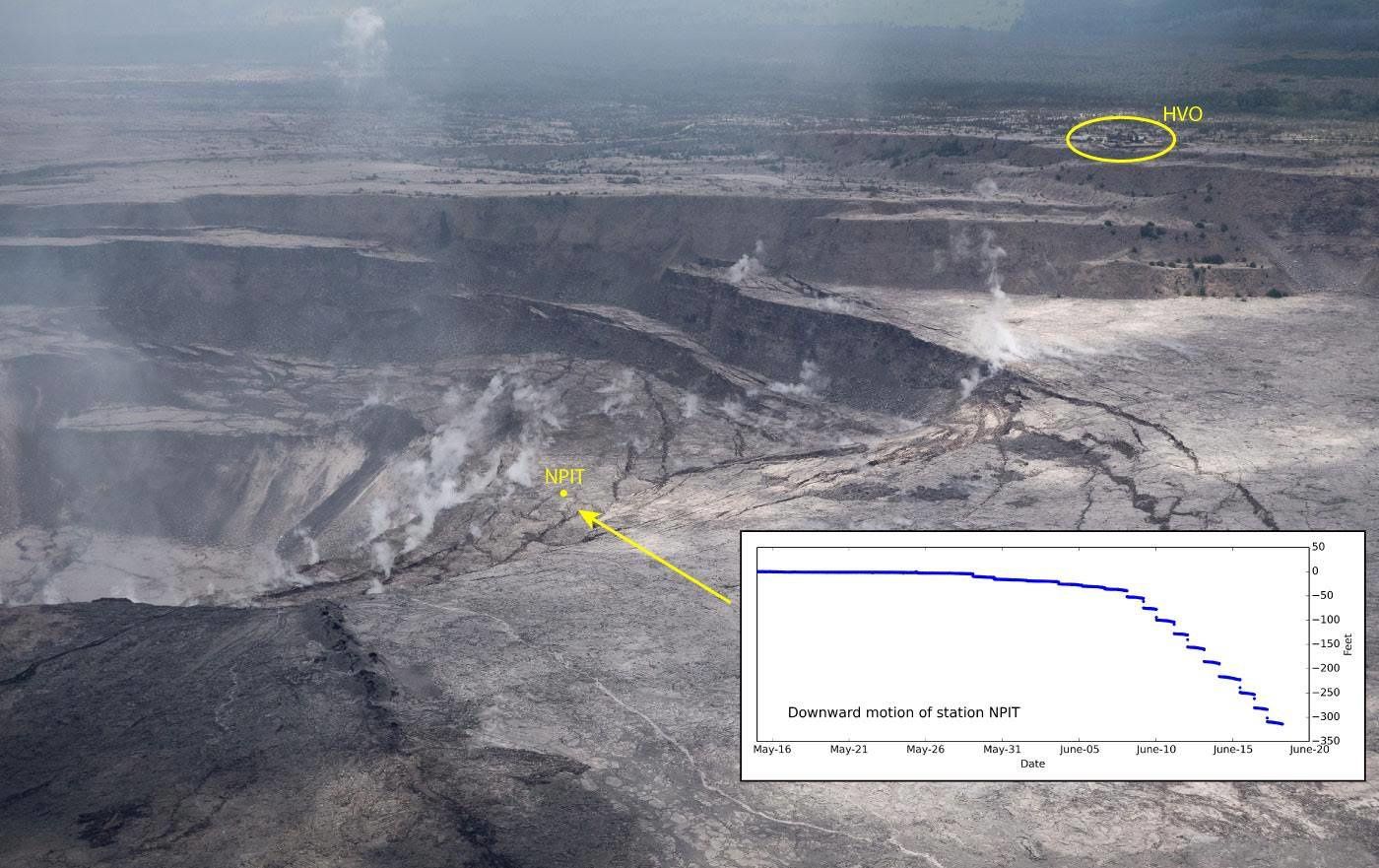
Kilauea summit - the fall of the NPIT station of 95 meters from its original position no longer allows communication with the observatory - USGS photo

Kilauea top - the deflation recorded over the last 2 months exceeds the inflation recorded over the last 5 years - Doc. 25.06.2018 / USGS
Thème Magazine - Hébergé par Overblog


/image%2F0935525%2F20221031%2Fob_614820_2022-10-30-18h33-wit-gunung-ibu-p.jpg)
/https%3A%2F%2Fi.ytimg.com%2Fvi%2FoOCJ-5qxdO8%2Fhqdefault.jpg)
/image%2F0935525%2F20221029%2Fob_ff7a2c_2022-02-28-22h06-utc-pavlof-sat-wor.png)
/image%2F0935525%2F20221028%2Fob_fb9420_2022-10-26-survol-du-cotopaxi-par-le-f.jpg)