
Actualité volcanique, Articles de fond sur étude de volcan, tectonique, récits et photos de voyage
Par Bernard Duyck
Some details about the new eruption started on August 31 in Holuhraun:
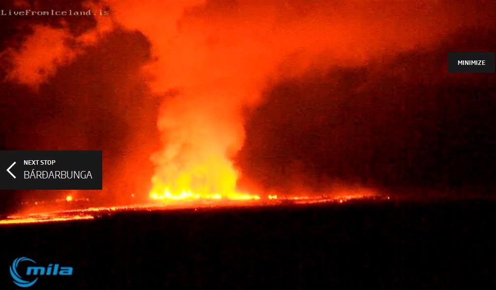
The fissure is estimated to be a 1.5 km long. The lava flow resulting measured 3 km long in NE direction, with a width of about 1,000 meters, at 7am. The cast are several meters thick, with a large flow of about 1,000 cubic meters per second.
Activity of the fissure in Holuhraun after storm - 08/31/2014 / 8:38 p.m. - photo BwZBi7nIgAAvCDZ Twitter
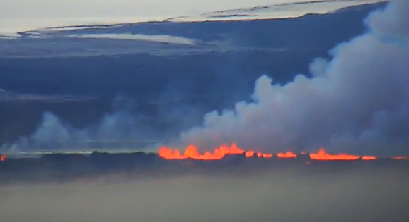
This September 1st, the fissure eruption continues stably in Holuhraun. It remains effusive without explosive activity, but characterized by a light cloud of condensation.
Holuhraun - webcam Mila 09.01.2014 / 6:43

Holuhraun - the eruptive fissure at dawn on 09/01/2014 - Mila webcam

Holuhraun - lava that around 9am 01/09/2014 - photo Eggert / mbl.is / Twitter
The ratio of earthquakes decreased following the decompression, but they are still present, with 250 episodes this morning, the largest up to M2. Most are located in the northern part of the intrusion, between the eruptive site, and to the south, 10 km. under Dyngjujökull.
Stronger earthquakes characterize the edges of the caldera of Bardarbunga volcano : from 4:59 to M4,5 on the northernrim, and M4.2 at 3:09 on the southern rim.
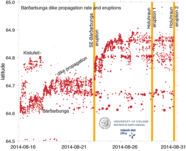
Spread of intrusive dyke from 16.08 - doc. University of Iceland / IMO / 31/08/2014
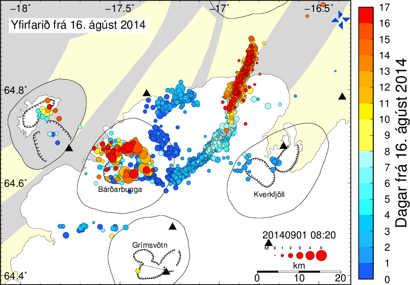
Earthquake location on Bardarbunga-Holuhraun region between 16.08 and 09.01.2014 - the most recent earthquakes in red / see colorful daily scale margin - map IMO
Region of Askja is described as seismically quiet. We note, however, earthquakes in the area of the Herðubreið, one of M2,9 at 2:56. This area is seismically active, and this activity is not necessarily linked to an increasing of the stress by the intrusion whose end is 25 km. further south.

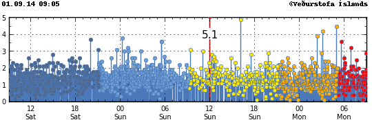
Location and magnitude of earthquakes on 01/09/2014 at 9:05 am - Doc. IMO
Sources :
- IMO
- University of Iceland
- Webcam Mila
- mbl.is
Thème Magazine - Hébergé par Overblog


/image%2F0935525%2F20221031%2Fob_614820_2022-10-30-18h33-wit-gunung-ibu-p.jpg)
/https%3A%2F%2Fi.ytimg.com%2Fvi%2FoOCJ-5qxdO8%2Fhqdefault.jpg)
/image%2F0935525%2F20221029%2Fob_ff7a2c_2022-02-28-22h06-utc-pavlof-sat-wor.png)
/image%2F0935525%2F20221028%2Fob_fb9420_2022-10-26-survol-du-cotopaxi-par-le-f.jpg)