
Actualité volcanique, Articles de fond sur étude de volcan, tectonique, récits et photos de voyage
Par Bernard Duyck

Nishinoshima - July 23, 2014, three craters emit plumes of gas - photo Maritime Safety Agency
The eruption off Nishinoshima, a small volcanic island located in Izu-Bonin arc, 940 kms south of Tokyo, has created a new island emerging on November 20, 2013, originally called Niijima (New Island). Its growth did first join the existing island, then cover largely. The island is commonly called "Nishinoshima."
The active craters, numbering three in August, continues to spit lava at the rate of 200,000 cubic meters each day ... it accumulates mainly eastward.
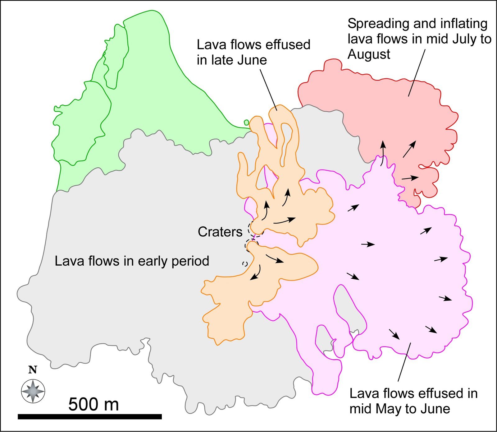
Nishinoshima - evolution and distribution of lava flows from May to August 2014 - doc eri.u-tokyo
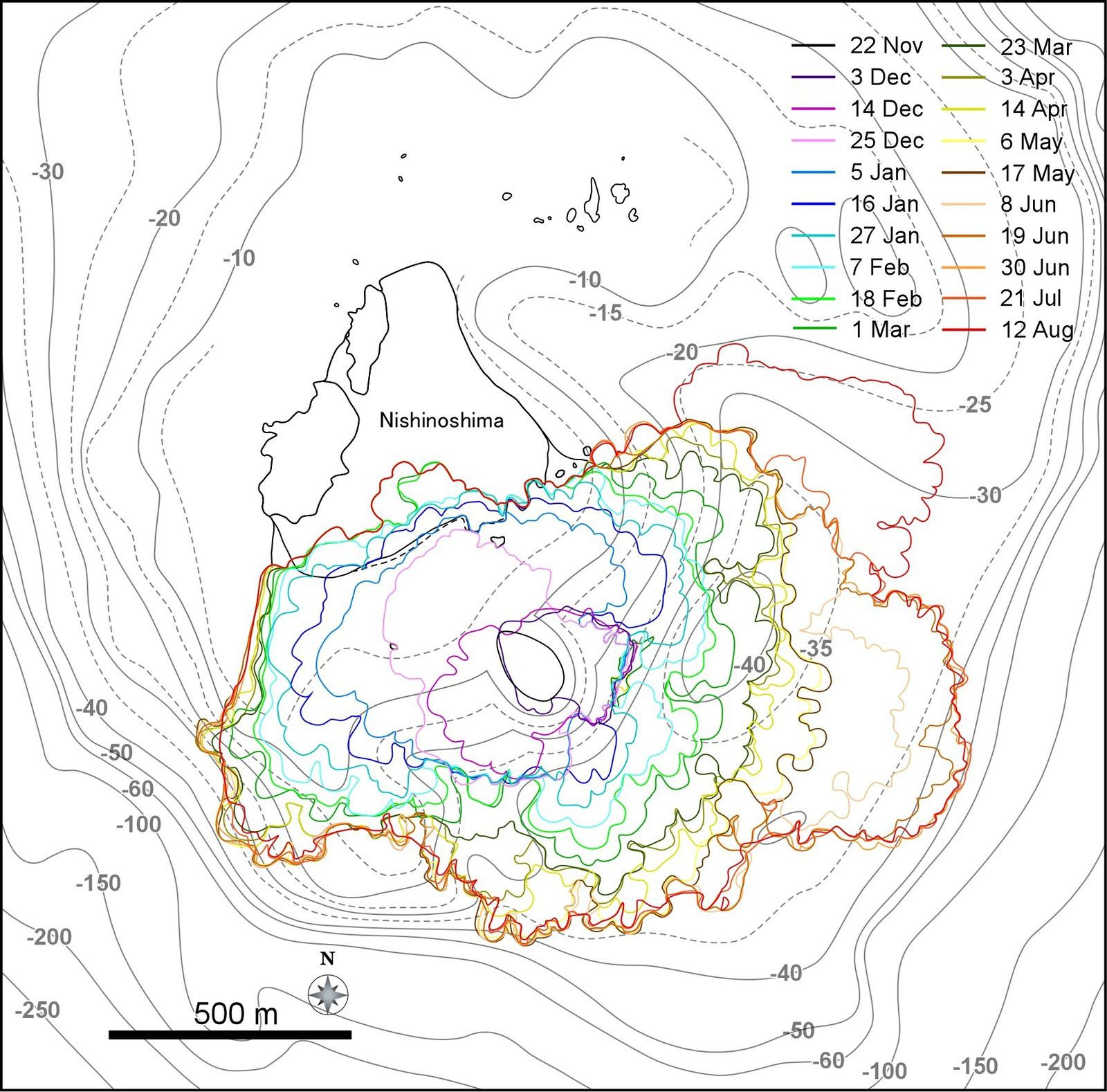
Nishinoshima - changing contours of the island since the beginning of the activity 2013/2014 - doc eri.u-tokyo
A scientist from the University of Tokyo / Earthquake research institute, Fukashi Maeno, warned that "if the lava continues to accumulate in the East Zone, part of the slopes of the island could collapse and cause a tsunami ... the collapse of a volume of 12 million cubic meters may generate a tsunami of one meter, movable to the speed of an express train, and touch Chichijima island, 130 km away. over about 18 minutes ".
Chichijima, the largest island of the Ogasawara, is home to some 2,000 people.
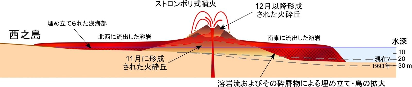
Nishinoshima - evolution and distribution of lava flows - the cut let see an accumulation of lava, to the right of theschema - Doc eri.u-tokyo
He added that "the ideal way to monitor the situation and prevent a natural disaster would be to install a system to detect tsunamis and earthquakes near the island, but it is impossible for anyone to land on the island now" .
JMA / Japan Meteorological Agency seismic remains attentive to the slightest signal, while studying various simulations for possible precautionary measures to be taken.
The volcanic islands are customary of flank collapse, more or less important, creating problems for the coasts of the island itself, but also those of the surrounding land. These debris avalanches were analyzed particularly on the volcanic Canary Islands.
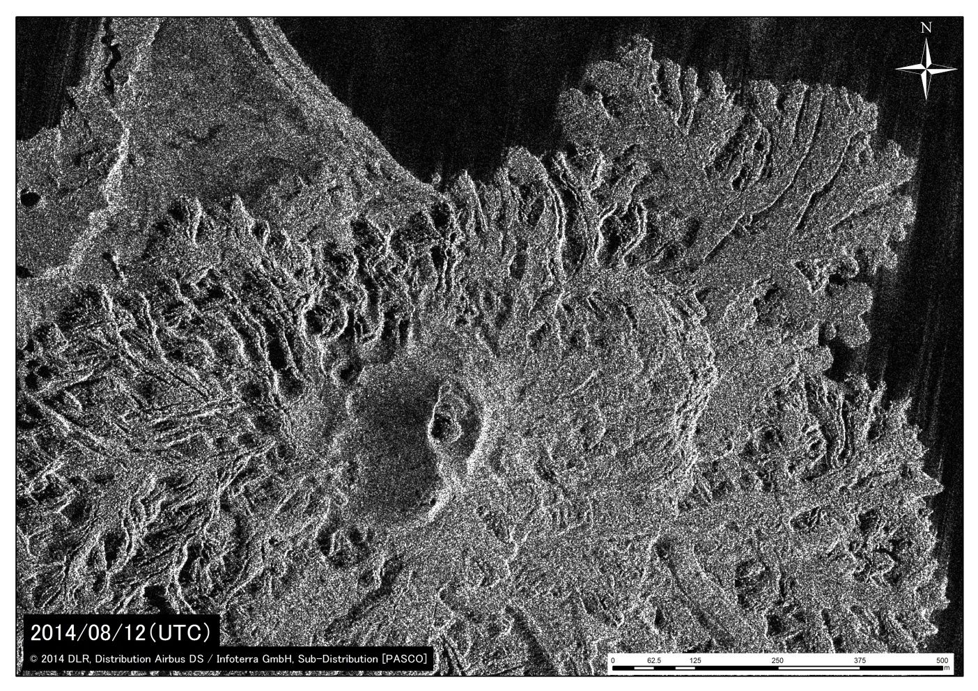
Nishinoshima - image of the last lava flows eastward from mid-July - doc eri.u-tokyo / Image satellite TerraSAR-X (co Pasco Corporation) 12/08/2014
Thème Magazine - Hébergé par Overblog


/image%2F0935525%2F20221031%2Fob_614820_2022-10-30-18h33-wit-gunung-ibu-p.jpg)
/https%3A%2F%2Fi.ytimg.com%2Fvi%2FoOCJ-5qxdO8%2Fhqdefault.jpg)
/image%2F0935525%2F20221029%2Fob_ff7a2c_2022-02-28-22h06-utc-pavlof-sat-wor.png)
/image%2F0935525%2F20221028%2Fob_fb9420_2022-10-26-survol-du-cotopaxi-par-le-f.jpg)