
Actualité volcanique, Articles de fond sur étude de volcan, tectonique, récits et photos de voyage
Par Bernard Duyck
The eruption of Pavlof, which began on November 12, intensified on November 14, bringing the aviation code to Red and the volcanic alert to Warning.
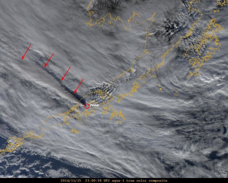
Pavlof: Modis An image showing the extension of the cloud over 400 km at an estimated altitude of at least 10,600 meters. - Image Daveschneider / AVO-USGS
The tremor remains at a high level. The ash plume rises about 9,000 meters after the pilot report (11.14.2014 / 24:30) before moving to north-west over the Bering Sea. A Modis image shows an extension of the cloud over 400 km at an estimated altitude of at least 10,600 meters. The ash cloud is moving away from populated areas, and no ash fall is reported by the locals.
Pavlof - movement of the ash cloud 16.11.2014 / 5:32 UTC - Doc. NOAA / National weather Service

Pavlof - Tremor on 11/15/2014 - Doc. AVO USGS

Pavlof - movement of the ash cloud 16.11.2014 / 5:32 UTC - Doc. NOAA / National weather Service
Source :
Alaska Volcano Observatory
Thème Magazine - Hébergé par Overblog


/image%2F0935525%2F20221031%2Fob_614820_2022-10-30-18h33-wit-gunung-ibu-p.jpg)
/https%3A%2F%2Fi.ytimg.com%2Fvi%2FoOCJ-5qxdO8%2Fhqdefault.jpg)
/image%2F0935525%2F20221029%2Fob_ff7a2c_2022-02-28-22h06-utc-pavlof-sat-wor.png)
/image%2F0935525%2F20221028%2Fob_fb9420_2022-10-26-survol-du-cotopaxi-par-le-f.jpg)