
Actualité volcanique, Articles de fond sur étude de volcan, tectonique, récits et photos de voyage
Par Bernard Duyck
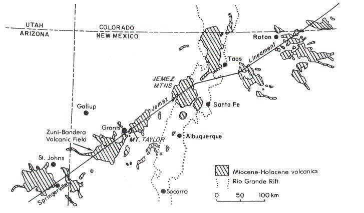
Tectonic and location of the volcanic fields on the Jelez lineament, near Albuquerque.
On the alignment Jemez and north of Zuni-Bandera volcanic field, Mount Taylor is a conglomeration of several volcanic centers compounds by different magma.
Its symmetrical structure is the result of the accumulation of thick, sticky trachydacitic lava flows, then trachyandesitic, over traces of ancient rhyolitic eruptions, complemented by an outside apron radiating of debris from the domes, mixed with pyroclastic materials.
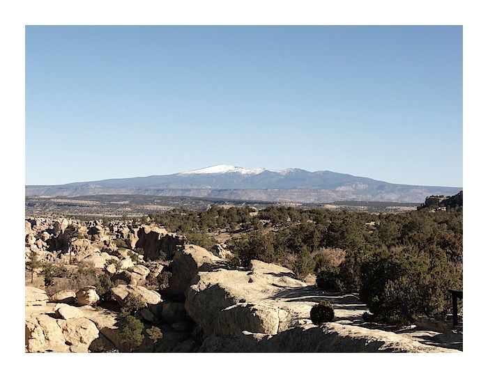
The Mt.Taylor seen from Sandstone Bluffs Overlook / El Malpais - Larry Crumpler Photo / New Mexico Museum of Natural History and Science.
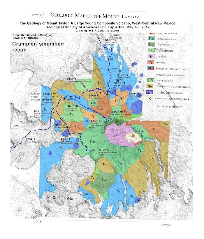
Geological map of Mount Taylor - location of the different type of lava - Doc. NMM / L.Crumpler & F.Goff

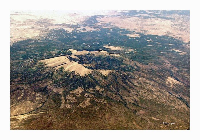
Topography of Mt Taylor - photo Nasa / New Mexico Museum of Natural History and Science.
Mount Taylor - Photo taken by Dr. Larry Crumpler / New Mexico Museum of Natural History and Science.
Radial dikes of trachyandesites in the summit amphitheater represent feeder dykes of many viscous intrusions.
A pyroclastic cone could have enthroned in the central part animated of this extrusive activity; he contributed to the production of materials that cover the lower slopes of the volcano of little colored fine ash and wide size blocks of trachydacite ... the final explosive activity and erosion have played a key role in the destruction of the summit.
Remains today a truncated cone, centered on the head of Water Canyon in a valley in amphitheater, with east, the peak of Mount Taylor and peak La Mosca.
Various hypotheses are scaffolded on the original height of Mount Taylor ... with as result, the average score elevation of around 4,000 meters.

Mt Taylor , seen from the north-west of Interstate 40 near Mesita - photo NMM

Mt Taylor cross section, seen from the south - doc.Lipman & Mehnert 1980
Thème Magazine - Hébergé par Overblog


/image%2F0935525%2F20220824%2Fob_233d4b_thrihnukagigur-volcano-guide-to-icelan.jpg)
/image%2F0935525%2F20220111%2Fob_894d24_particolare-dei-colli-euganei-il-mon.jpg)
/image%2F0935525%2F20201012%2Fob_4fcdc5_img-8284-copie.jpg)
/image%2F0935525%2F20200802%2Fob_46d8ae_columbretes-seis1-castellonturismo.jpg)