
Actualité volcanique, Articles de fond sur étude de volcan, tectonique, récits et photos de voyage
Par Bernard Duyck
The West Mesa regio is located west of the city of Albuquerque, in the middle of the rift valley of the Rio Grande. The Rio Grande rift valley is one of the few active air rifts, such as the Great East African Rift, the Rhine Graben and the rift Lake Baikal in Russia.
This area of weakness and stretching of the crust promoted the formation of numerous cracks through which the magma has found ways to rise to the surface.
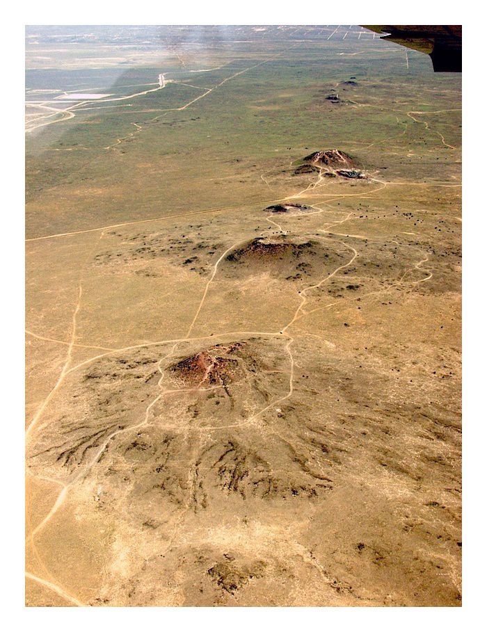
Albuquerque volcanic field - photo Larry Crumpler - NMM
Over a length of 8 km., 150,000 years ago, the fissure eruptions formed curtains of fire, as in Hawaii, and are responsible for six lava flows that covered the Santa Fe Formation, an accumulation of gravel and sand.
The first two additions, the most important, created the lava plateau of West Mesa. With the cooling of the lava flows, the cracks are blocked, and the residual lava has formed cinder and spatter cones. Three cones are most important and prominent on the western edge of the site ... they are known as the Three Sisters: Vulcan, Black and JA volcanoes.
Particularly visible in the cone Vulcan, an asymmetry of the cone is noticed due to the wind direction at the time of the eruption. The crater of Vulcan contains a small lake of basaltic solidified lava, with underdeveloped colonnades. Sinuous lava tubes are preserved on the NE & NW flanks of the cone.
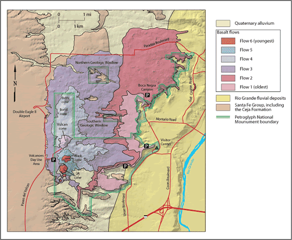
The six lava flows and the position of cones and petroglyph sites - one click to "Lighten" the legends - Doc. Geology from Connell (2008) ./ http://geoinfo.nmt.edu/tour/federal/monuments/petroglyphs/map_abq_volcanoes.pdf

Petroglyh NM - the Thress sisters : Black, JA and Vulcan volcanoes - photo American southwest


Left, JA volcano - right, Black volcano - one click to enlarge - photos Michaelh2001
Erosion by wind and rain over thousands of years of the Santa Fe undermying Formation
, more friable and therefore faster than the basalt layer surmounting, removed a significant portion of material. the basaltic layer private of support broke and collapsed in large blocks forming the current escarpment.


Formation of West Mesa and of the boulders of Petroglyph NM - NPS schemes -. one click to a separate vision.
The Petroglyph National Monument:
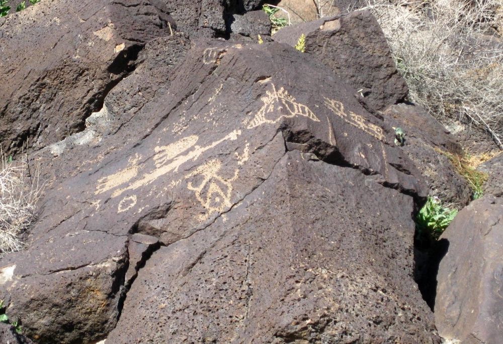
The boulders were used by the native and mestizo populations with the Mexicans and Spaniards for the realization of more than 24,000 petroglyphs, mostly dating from ancestral Pueblo period, between 1300 and 1600.
That's the nature of basalt blocks that made visible these petroglyphs. Basalt, gray originally, discolored following an oxidation phenomena ... The high content of iron, manganese and calcium allowed, following exposure to oxygen and the water, the formation of a dark patina on the surface, called the "desert varnish."

Petroglyphs in a basalt boulder in Rinconada Canyon - photo american southwest
Petroglyphs - photo american southwest
The engraving of the blocks highlighted these intricate designs, depicting scenes of hunting, animals, humans, masks and other geometric shapes, by scraping the varnish layer. They had a cultural and spiritual significance to the original inhabitants and retain a great value for their descendants.
They are grouped in three main canyons, the Rinconada, Boca Negra and Piedras Marcadas canyons, grouped in Petroglyph National Monument, recently established in 1990.

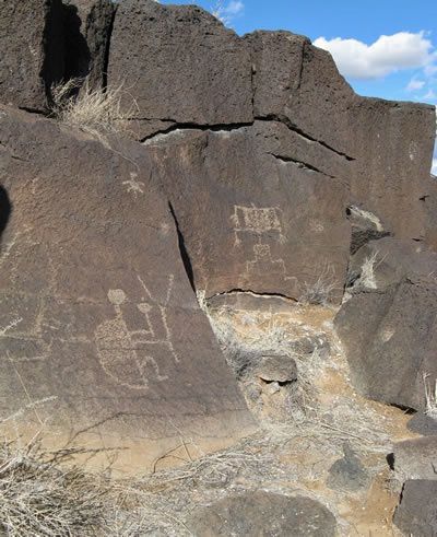
A "star character" in Rinconada section of Petroglyph NM - photo Jerry Willis
Thème Magazine - Hébergé par Overblog


/image%2F0935525%2F20220824%2Fob_233d4b_thrihnukagigur-volcano-guide-to-icelan.jpg)
/image%2F0935525%2F20220111%2Fob_894d24_particolare-dei-colli-euganei-il-mon.jpg)
/image%2F0935525%2F20201012%2Fob_4fcdc5_img-8284-copie.jpg)
/image%2F0935525%2F20200802%2Fob_46d8ae_columbretes-seis1-castellonturismo.jpg)