
Actualité volcanique, Articles de fond sur étude de volcan, tectonique, récits et photos de voyage
Par Bernard Duyck
Located as the Kurile Lake in the Pauzhetka caldera, dated 443,000 years , the complex of domes Diky Greben covers more than 60 km ².
The complex consists of Mont Nepriyatnaya - "Unpleasant " , the main dome , many flanks domes , their lavas and pyroclastic flows ; it is the largest extrusive block of the Kamchatka - Kurile arc .

The Diky Greben complex , Mt Nepriyatnaya , its N & S flows, and , in the background , the Kuril Lake - / KSCNET Photo Nikolai Smelov
The complex is formed during three short periods of activity separated by long rest periods of about 3,000 years each.
- His life begins to 5700-5600 BC, after the collapse of the caldera of Lake Kuril .
- The second phase takes place between 3500 and 2250 BC.
- The greater part of the complex, including lava north and south of Mt Nepriyatnaya , was formed during an eruption in the year 350 : on the north of the latter, a thick lava flow lined with well expressed levees, and south, a topography that marks its origins in a sector collapse of the main lava dome. A total of 9-10 km ³ of dacite and 2-3 km ³ of andesite was issued at that time.
Two large craters and some smaller vents were formed thereafter.
During these three phases , deformation and landslides occurred , some constituting dams on the Ozernaia River, the drainage of Lake Kuril .
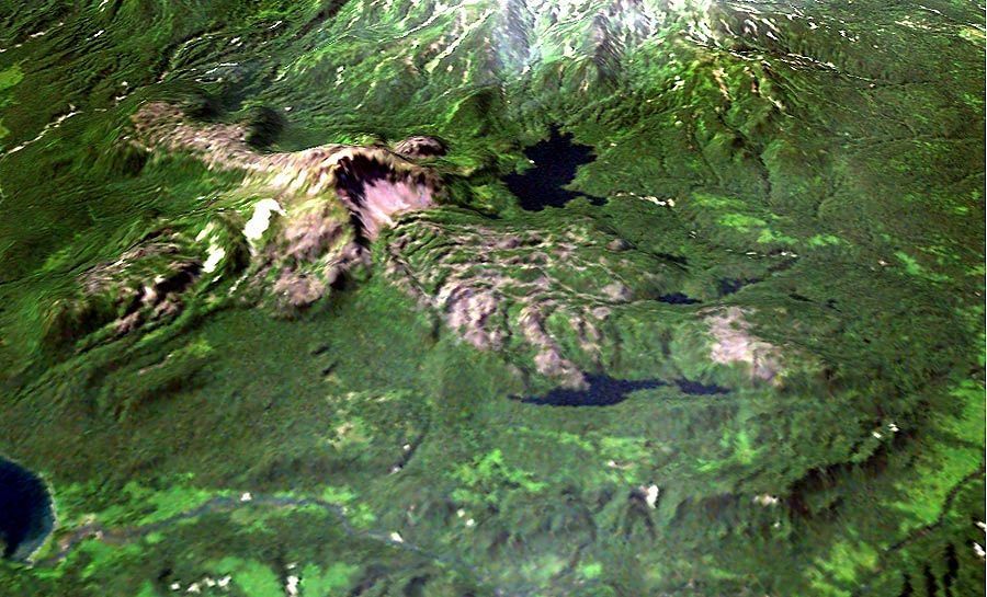
Diky Greben - Mt Nepriyatnaya and his flows - Landsat 7 image of Dikii Greben ' volcano draped over a digital elevation model . Processed by Dmitry Melnikov .
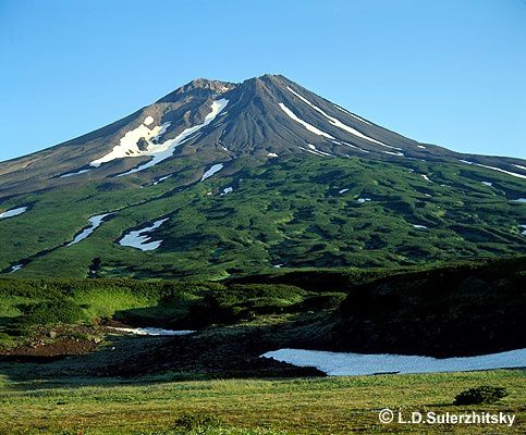
The Kambalny , located south of the volcano -tectonic depression Pauzhetka is the major stratovolcano the southernmost of the peninsula of Kamchatka .
Peaking at 2156 meters, it consists of two cones : in the west, a cone formed there about 6,300 years , was destroyed by a large collapse 6,000 years ago ( radiocarbon ), which has generated at least three avalanches debris , estimated between 5 and 10 km ³ of total volume.

The Kambalny - photo Igor Shpilenok / live newspaper
The first avalanche traveled 14 km south-easterly direction . A new cone is then formed in the crater , following strong explosive eruptions . Another collapse involved as the former cone cone as the new emerging cone, forming a deposit of 20 km long and 5 wide, to the SSO of the volcano. The third debris avalanche , which traveled more than 10 km NE, is dominated by hydrothermally altered rocks of the former ridge.
Subsequent eruptions have built the new cone, that filled a part of the collapsed crater, forming an asymmetric structure. The present crater is 800 meters wide by 400, and 150 m deep . Five cinder cones dot the flanks of the volcano .
The clearance between the hummocks of the debris avalanches deposits is now occupied by peatlands , which protected all the thin layers of ash from the volcanoes of South-Kamchatka and history.
The last major eruption of Kambalny date of 1350 ; the phreatic eruption left debris on the southwest slopes of the volcano . Subsequent smaller eruptions have produced lahars .
Kambalny - area avalanche hummock swamp - photo LD Shulerzhitsky
Its current activity is confirmed by the presence of zones of fumaroles , hot springs and mud pots in nine areas concentrated on the dorsal Kambalny dominant the tundra of 800-1000 meters.
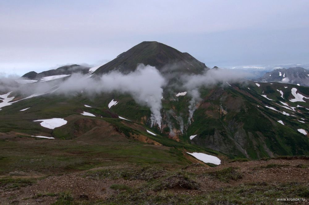
Hydrothermal field near Black Cliffs / Kambalny volcano - photo I.Shpilenok / Kronoki.ru

Hydrothermal field near Black Cliffs / Kambalny volcano - photo I.Shpilenok / Kronoki.ru
Sources :
- KSCNET - Holocene Kamchaka volcanoes - link
- Global Volcanism Program - Diky Greben
- Gloval Volcanism Program - Kambalny
Thème Magazine - Hébergé par Overblog


/image%2F0935525%2F20220824%2Fob_233d4b_thrihnukagigur-volcano-guide-to-icelan.jpg)
/image%2F0935525%2F20220111%2Fob_894d24_particolare-dei-colli-euganei-il-mon.jpg)
/image%2F0935525%2F20201012%2Fob_4fcdc5_img-8284-copie.jpg)
/image%2F0935525%2F20200802%2Fob_46d8ae_columbretes-seis1-castellonturismo.jpg)