
Actualité volcanique, Articles de fond sur étude de volcan, tectonique, récits et photos de voyage
Par Bernard Duyck
A small tour by Kilauea, where the eruption continues in the summit area and the east rift zone.
In the latter, the "lava flow of 27 June" continues its advance towards the north-east, progressing through a wooded area in surface, creating bushfires. The lava also moves in subsurface ... the phenomenon is visible by the steam emitted, from locations, at cracks.
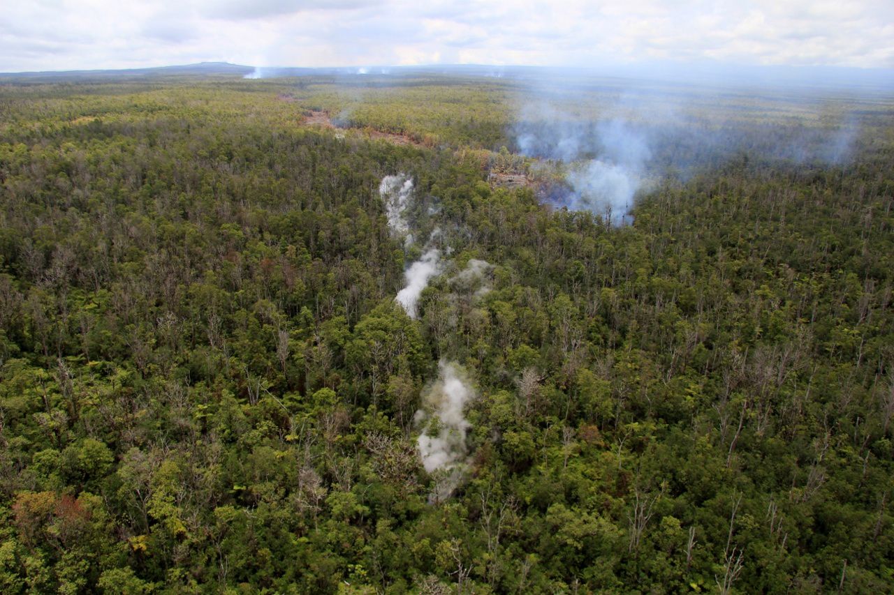
In the background, the Pu'u O'o - in the center of the photo, steam from the subterranean lava flow, almost straight - on the right progression of the lava in surface, as evidenced by bushfires and the drag behind - photo HVO / USGS
A survey by the Civil Defense, on September 1, was used to map the position of the flow front, currently at 12.5 km from the vent.
This overview showed an advancing cast, which plunges underground in old cracks open in the Puna Forest Reserve ... phenomenon rarely seen !
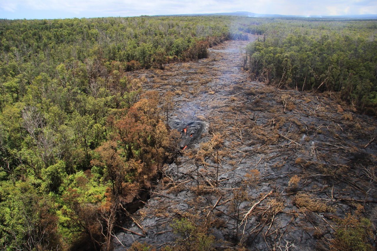
Kilauea / the "lava flow of June 27" - the trace left by the flow in surface and left the picture, the place where it plunges back underground. - Photo HVO / USGS

Zoom over the diving of the lava into the crack and his return to underground - photo HVO / USGS 01.09.2014
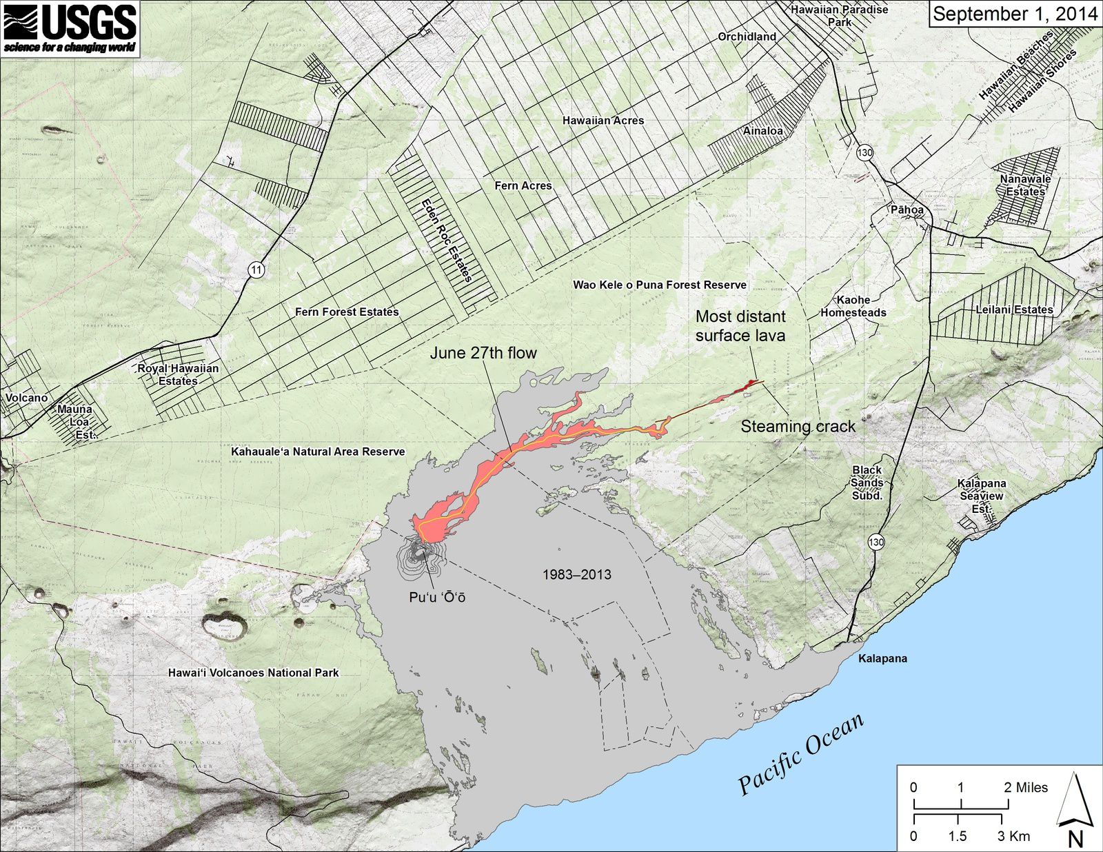
Map of the progression of the Flow of June 27 - expanding by one click, you can see, as in the photo at the top of the article, the "smoking" crack has exceeded the level of casting surface.- map HVO / USGS
Source ;
HVO - Hawaiian Volcano Observatory.
Thème Magazine - Hébergé par Overblog


/image%2F0935525%2F20221031%2Fob_614820_2022-10-30-18h33-wit-gunung-ibu-p.jpg)
/https%3A%2F%2Fi.ytimg.com%2Fvi%2FoOCJ-5qxdO8%2Fhqdefault.jpg)
/image%2F0935525%2F20221029%2Fob_ff7a2c_2022-02-28-22h06-utc-pavlof-sat-wor.png)
/image%2F0935525%2F20221028%2Fob_fb9420_2022-10-26-survol-du-cotopaxi-par-le-f.jpg)