
Actualité volcanique, Articles de fond sur étude de volcan, tectonique, récits et photos de voyage
Par Bernard Duyck
The Tharsis volcanic province covers an area corresponding to 25% of the Martian surface , a diameter (ground surface) of about 8,000 km. It is characterized by an extensive volcanism and tectonic activity .
Various hypotheses for its formation and evolution :
- An uprising of the lithosphere caused in the mantle or the crust of Mars by a thermal , chemical, or dynamic anomaly , would have led to a fracturing of the lithosphere and later the establishment of the volcanism and the giants shield volcanoes.
- The topography of the Tharsis Province could have been produced by construction, rather than by raising another hypothesis. Elastic and heterogeneous lithosphere has been subject to fracturing , and a volcanism concentrate on that area .
Anyway, the volcanism was active until a currently 100 to 250 Ma, which is the recent geological worldwide , estimated at 4.6 billion years.

Volcanic Tharsis Province / MARS - doc . ESA / DLR / FU Berlin (G. Neukum ) - Original Image by NASA data
The Tharsis Mountains are a chain of volcanoes, located on the Tharsis bulge . The three main summits are Acraeus Mons, 18,225 m. , Pavonis Mons, 14,058 m. and Arsia Mons, 17,761 m.
Ascraeus Mons is the second highest summit in March , after Olympus Mons , the volcano of superlatives , with 21,229 m. , located northwest of Tharsis Mountains .
Throughout, the high density of volcanoes corresponds to a basaltic composition , consistent with that of Martian meteorites fallen on Earth.
New data show a change in density during the construction of the chain of volcanoes . At first, we deal with andesitic lava , lighter , and related to the presence of water, then with basaltic lava heavier.
The age is going from Arsia Mons volcano, the oldest , Pavonis Mons and finally Acraeus Mons, the youngest. ( M.Beuthe / Royal Observatory of Belgium / Journal of Geophysical Research)

Tharsis mountains , February 22, 1980 . From bottom to top , the mountains Arsia , Pavonis and Ascraeus - Image reconstructed from a mozaïque of images captured by the Viking probe
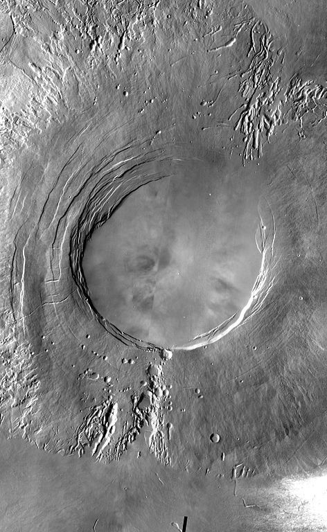
Arsia Mons - photo NASA - JPL -Caltech - Arizona State University

Perspective view of Arsia Mons - doc . reconstituted by combining images from the Viking probe and elevation data / Planetary remote sensing, Martian landscapes .
Arsia Mons is a large shield volcano, 460 km wide , with a caldera of 110 km. diameter , overlooking the Tharsis bulge of 9-11000 meters. It peaks at 17,761 meters, compared to the baseline of Mars . Its sides have an average inclination of 5 ° , with side lobes inclined from 1 to 4°.

Topography of the lava flows in Daedalia Planum - Doc ESA - http://www.esa.int/Our_Activities/Space_Science/Mars_Express/Lava_flows_in_Daedalia_Planum
His flows are on the same scale : a publication of the ESA on images taken by the Mars Express probe on November 28, 2013 revealed the existence of two distinct flows of lava which flooded an area of Daedalia Planum , located about 1000 km . southeast of the volcano.
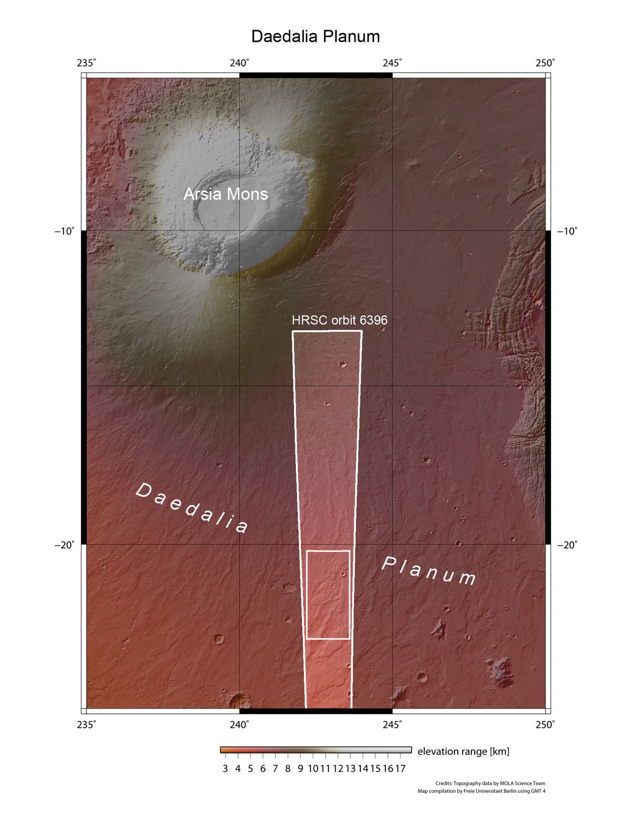
Daedalia Planum, a plain SE of Arsia Mons - doc . ESA

Daedalia Planum and his lava flows in perspective - doc . ESA
These flows are of different ages , such as craters impacts shows.
The oldest , fractured , contains more impact craters , and larger than the younger.
The latest flow has various features including pressure ridges and a lava channel . Older flow has in its lower part a smoother surface , due to the accumulation of sediments. Impact craters show signs of modification, the largest of which is not affected by the lava flow , but whose ejecta formed during the impact is partially covered with lava.
Sources :
- Evolution of the Tharsis volcanic Province - by Sean C.Solomon - MIT - link
- ESA - Space sciences - Lava flows in Daedalia Planum - link
Thème Magazine - Hébergé par Overblog


/image%2F0935525%2F20221112%2Fob_03b696_ethiopie-scanner-bd-018.jpg)
/image%2F0935525%2F20221111%2Fob_1285d5_site-troglodyte-de-jonas-jmm.jpg)
/image%2F0935525%2F20221108%2Fob_d0f7fc_site-troglodyte-de-jonas-jmm.jpg)
/image%2F0935525%2F20221110%2Fob_af1829_puy-mary-2-jmm-1-28-10-2022.jpg)