
Actualité volcanique, Articles de fond sur étude de volcan, tectonique, récits et photos de voyage
Par Bernard Duyck
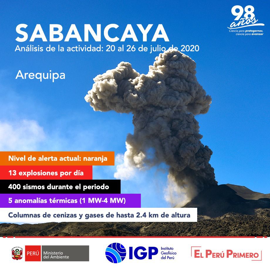
The Geophysical Institute of Peru (IGP) reports that the eruptive activity of the Sabancaya volcano remained between July 20 and July 26 at moderate levels, with the continuous recording of explosions, on average 13 per day, with plumes of gas and ash up to 2.6 km above the top of the volcano.
The IGP recorded and analyzed the occurrence of about 400 earthquakes of volcanic origin, associated with the circulation of magmatic fluids (magma, gas, etc.) inside the volcano.
The monitoring of the deformation of the volcanic structure, using GNSS data (processed with fast orbits), did not show any significant anomalies; however, a slight inflation was recorded in the northern sector (Hualca Hualca volcano) and south-eastern flank of the Sabancaya volcano. Satellite monitoring has identified the presence of 5 thermal anomalies with values between 1 MW and 4 MW VRP, associated with the presence of a lava body on the surface of the volcano crater.
The volcanic alert level remains orange, with a prohibited area of 12 km in radius around the crater.
Source: IG Peru
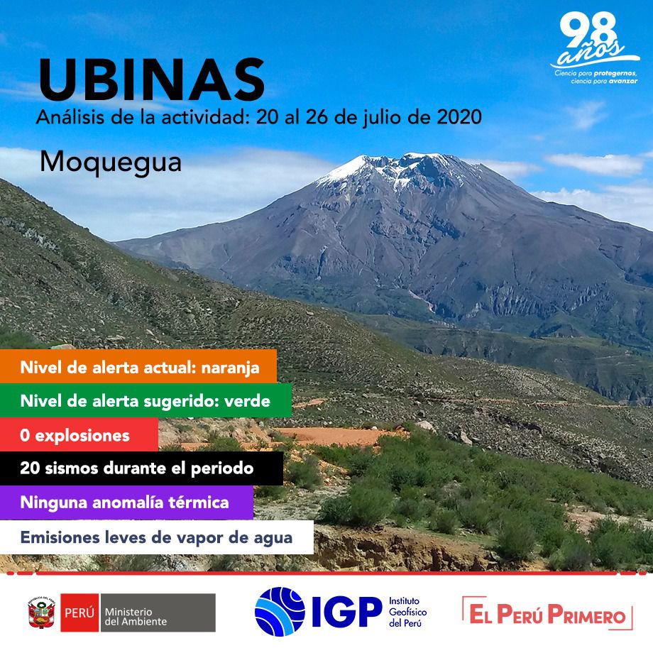
The Ubinas volcano (Moquegua region) continues to show a slight increase in its seismic activity between July 20 and July 26; twenty earthquakes of magnitudes less than M1.5, associated with rock breaking processes that occur inside the volcano have been recorded; similarly, 6 seismic signals were recorded which would be associated with the movements of volcanic fluids (water vapor and gas); Within these, 2 tornillo-type events were identified which would be linked to the increase in the internal pressure of the volcano. No seismic activity linked to the rise of magma is observed.
Surveillance cameras recorded columns of gas and water vapor reaching heights of up to 700 m above the summit of the volcano, dispersed towards the southeastern sector of the volcano.
The monitoring of the deformation of the volcanic structure, using GNSS instruments, as well as the satellite monitoring via the SENTINEL, IMO-NASA (SO2 gas) and MIROVA (thermal anomalies) systems did not record any anomalies. during the analysis period.
The volcanic alert level remains at Naranja, with a forbidden zone of 3 km in radius around the crater
Source: IG Peru

The US Geological Survey's Hawaiian Volcanoes Observatory (HVO) recorded a magnitude 4.7 earthquake between Lōʻihi seamont and the southern tip of the island of Hawaii on Monday, July 27 at 6:06 a.m. HST .
The earthquake was centered about 20 km (12.4 miles) southeast of Nā’ālehu, at a depth of 35 km (21.7 miles). Slight shaking, with a maximum intensity of IV, has been reported in parts of the island of Hawaii. At this intensity, significant damage to buildings or structures is not expected.
Acting HVO scientist David Phillips said the earthquake had no apparent effect on Kīlauea or Mauna Loa volcanoes. "We are not seeing any detectable change in activity at the summits or along the Mauna Loa or Kīlauea rift zones as a result of this earthquake. Aftershocks are possible and could be felt." The HVO continues to monitor Mauna Loa and other Hawaiian volcanoes for any changes.
The depth, location and recorded seismic waves of the earthquake suggest a source due to the bending of the oceanic plate under the weight of the Hawaiian island chain, a common source of earthquakes in this region. Aftershocks are possible and could be felt.
According to the Pacific Tsunami Warning Center, this earthquake does not threaten a tsunami.
Source: HVO
Thème Magazine - Hébergé par Overblog


/image%2F0935525%2F20221031%2Fob_eebb60_2022-10-30-18h33-wit-gunung-ibu-p.jpg)
/https%3A%2F%2Fi.ytimg.com%2Fvi%2FoOCJ-5qxdO8%2Fhqdefault.jpg)
/image%2F0935525%2F20221029%2Fob_a95208_2022-02-28-22h06-utc-pavlof-sat-wor.png)
/image%2F0935525%2F20221028%2Fob_bbab77_2022-10-26-survol-du-cotopaxi-par-le-f.jpg)